Property Record
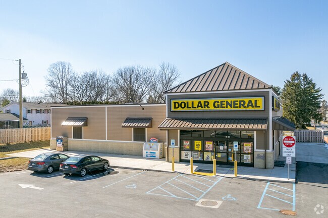
2032 Walbert Ave, Allentown, PA 18104


NEARBY LISTINGS FOR SALE OR LEASE
Property Detail
2032 Walbert Ave
Allentown-Bethlehem-Easton, PA-NJ
Clifford Park
549705249213-1
LOTS: 006
Storebuilding
Lehigh
X
Pennsylvania
42011C0250G
6
2025
1.22 AC
2025
Lehigh Valley
006001
Philadelphia
7,606 SF
DEMOGRAPHICS near 2032 Walbert Ave
1 Mile
3 Mile
5 Mile
2024 Total Population
14,307
124,709
233,144
2029 Population
14,444
125,821
234,955
Pop Growth 2024-2029
+ 0.96%
+ 0.89%
+ 0.78%
Average Age
41
38
39
2024 Total Households
5,745
46,224
88,449
HH Growth 2024-2029
+ 0.92%
+ 0.99%
+ 0.82%
Median Household Inc
$69,532
$52,385
$59,136
Avg Household Size
2.40
2.50
2.50
2024 Avg HH Vehicles
2.00
2.00
2.00
Median Home Value
$231,170
$208,007
$219,181
Median Year Built
1958
1956
1961
Nearby Places
Map Layers
Map Styles
 Street
 Aerial
- Restaurants
- Banks
- Shops
- Fitness
- Groceries
PUBLIC TRANSPORTATION
AIRPORT
Lehigh Valley International
DRIVE
WALK
Distance
Lehigh Valley International
12 min
6.2 mi
Freight Ports
Port of Philadelphia
DRIVE
WALK
Distance
Port of Philadelphia
81 min
62.1 mi
SALE & LEASE HISTORY
LISTING DATE
SALE/LEASE

Apr 30, 2020
For Sale
Nearby Properties
Address
Land Use
TOTAL SIZE
Lot Size
Zoning
Address
Land Use
TOTAL SIZE
Lot Size
Zoning
302,304 SF
5.15 AC
B-2
Address
Land Use
TOTAL SIZE
Lot Size
Zoning
353,441 SF
4.34 AC
I-G
Address
Land Use
TOTAL SIZE
Lot Size
Zoning
187,337 SF
2.11 AC
I-G
Address
Land Use
TOTAL SIZE
Lot Size
Zoning
74,985 SF
112.49 AC
RR-2
Address
Land Use
TOTAL SIZE
Lot Size
Zoning
230,853 SF
96.66 AC
R-3
Address
Land Use
TOTAL SIZE
Lot Size
Zoning
505,128 SF
25.92 AC
C-2
Address
Land Use
TOTAL SIZE
Lot Size
Zoning
356,283 SF
2 AC
I-G
Address
Land Use
TOTAL SIZE
Lot Size
Zoning
300,783 SF
0.64 AC
B-2
Address
Land Use
TOTAL SIZE
Lot Size
Zoning
295,502 SF
0.77 AC
B-2
Address
Land Use
TOTAL SIZE
Lot Size
Zoning
229,379 SF
1.16 AC
I-G
Address
Land Use
TOTAL SIZE
Lot Size
Zoning
175,714 SF
46.35 AC
R-3
Address
Land Use
TOTAL SIZE
Lot Size
Zoning
314,421 SF
2.22 AC
I-G
Address
Land Use
TOTAL SIZE
Lot Size
Zoning
1,250 SF
80.20 AC
CR
Address
Land Use
TOTAL SIZE
Lot Size
Zoning
113,608 SF
6.43 AC
I-G
Address
Land Use
TOTAL SIZE
Lot Size
Zoning
124,954 SF
1.23 AC
B-2
Address
Land Use
TOTAL SIZE
Lot Size
Zoning
155,344 SF
B-2
Address
Land Use
TOTAL SIZE
Lot Size
Zoning
266,354 SF
2.56 AC
R-H
Address
Land Use
TOTAL SIZE
Lot Size
Zoning
260,803 SF
36.23 AC
C-2
Address
Land Use
TOTAL SIZE
Lot Size
Zoning
165,557 SF
0.48 AC
B-2
Address
Land Use
TOTAL SIZE
Lot Size
Zoning
139,462 SF
1.30 AC
B-2
Address
Land Use
TOTAL SIZE
Lot Size
Zoning
113,162 SF
3.02 AC
B/LI
Address
Land Use
TOTAL SIZE
Lot Size
Zoning
222,783 SF
49.47 AC
R-3
Address
Land Use
TOTAL SIZE
Lot Size
Zoning
214,790 SF
12.09 AC
GC-1
Address
Land Use
TOTAL SIZE
Lot Size
Zoning
85,440 SF
2.10 AC
I-G
Address
Land Use
TOTAL SIZE
Lot Size
Zoning
11,850 SF
32.34 AC
R-ML
Address
Land Use
TOTAL SIZE
Lot Size
Zoning
123,432 SF
30.70 AC
C-2
Address
Land Use
TOTAL SIZE
Lot Size
Zoning
139,812 SF
0.14 AC
B-2
Address
Land Use
TOTAL SIZE
Lot Size
Zoning
208,086 SF
3.13 AC
R-H
Address
Land Use
TOTAL SIZE
Lot Size
Zoning
42,250 SF
3.33 AC
I-G
Address
Land Use
TOTAL SIZE
Lot Size
Zoning
326,320 SF
11.73 AC
PC
The World's #1 Commercial Real Estate Marketplace
Connect with us
© 2025 CoStar Group
The information above has been obtained from sources believed reliable. While we do not doubt its accuracy we have not verified it and make no guarantee, warranty or representation about it. It is your responsibility to independently confirm its accuracy and completeness. Any projections, opinions, assumptions, or estimates used are for example only and do not represent the current or future performance of the property. The value of this transaction to you depends on tax and other factors which should be evaluated by your tax, financial, and legal advisors. You and your advisors should conduct a careful, independent investigation of the property to determine to your satisfaction the suitability of the property for your needs.